MExp: Level Renders

2024-11-22

Earlier this year, I released MExp, a calculator remake of A Monster's Expedition by Draknek & Friends.
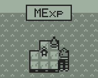
The cover image of MExp. In three-level greyscale, the player stands on an island surrounded by a tree, a rock, and a raft.

This article shows off some full-level renders.

Overview

I released MExp close to a year ago, now! Recently I thought it would be fun to build a tool to render out full MExp maps into images. Plus, whenever I finish a game, I almost always search the Internet for a full map of the game to look at. It's such a bummer when I can't find one.

I built this tool in C++, and for each MExp map fed in, it outputs a PPM1 image file with a render of the full map. You can find the tool on my GitHub: https://github.com/JosCla/MExp-Renderer.

It goes without saying: The images below will spoil the general structure and mechanics of MExp. Tread with care!

Major Maps

These are the major maps of MExp, leading the player from the beginning to the ending.

Map 1: Sandbank Islands
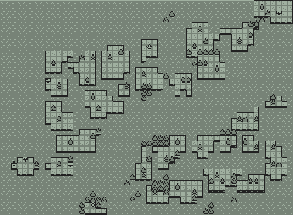
The first map of MExp. The map is a little wider than it is tall, and features several small and flat sandy islands on an ocean. The islands have rocks and trees on them.

Map 2: Grass Hills

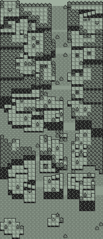
The second map of MExp. The map is much taller than it is wide, and depicts a small, sloping hill with a river running through the middle, down to a large ocean at the bottom. The hill is covered in trees and rocks.

Map 3: Flower Lake

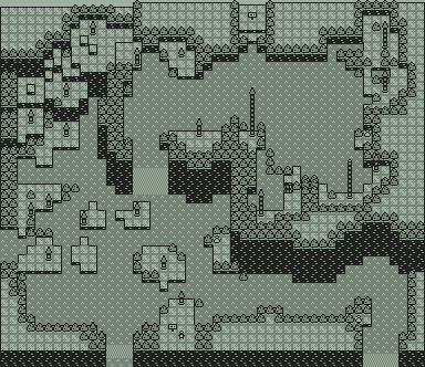
The third map of MExp. The map is a little wider than it is tall, and shows a large, two-tiered lake. The lower tier has trees twice as tall as seen in previous maps, spread across some islands in the lake. The upper tier has especially tall trees along its coast, up to ten times taller than seen in previous maps.

Map 4: Snow Spire

The fourth and final map of MExp. The map is much taller than it is wide, and contains a very sloping, vertical mountaintop. A massive river winds through the slopes. The top of the map is the mountain summit, against the open sky.

Digression Maps

These are the digression maps of MExp. They can be found by talking to snowfolk around each map. These maps explore interesting behaviors and edge-cases of the MExp engine.

Map D1.1: Log Maze

A small map with several logs strewn about a small island surrounded by rocks.

Map D1.2: Raft Ejection

A small map with a few tree and rock-covered islands.

Map D2.1: Rescue Raft

A small map. The player stands next to a massive stack of rafts with a snowperson on top.

Map D2.2: Obscured Mirror

A small map covered in trees and rocks. The right side is completely obscured by a massive rock wall.

Map D3.1: Icy Pond

A small map with a large lake in the middle. Notably, the lake is at ground-level, and resembles a sheet of ice.

Map D3.2: Caustic Bluff

A small map with several different-sized raft stacks next to the pond. The pond has a single rock in the middle - the infamously caustic bluff.

Map D4.1: Big Scalar

A small map with tiered hills and rivers. Many ladders can be seen throughout the map.

Map D4.2: Whimsy Raft

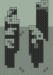
A medium-sized map with several tall, isolated pillars in the middle of an ocean. Curiously, logs and rafts float mid-air.

  1. PPM stands for Portable Pixel Map. I chose it for my tool because it's simple enough that I can just output pixels to a text file and call it a PPM. I didn't feel like roping in an extra image library! Though, PPM has a large file size on account of being a very simple format. In post-processing I used FFmpeg to convert to PNG. That way my pictures are portable and easy to send over a network connection to your web browser.